ERAS HEADSHOT / PHOTO METADATA
Can an ERAS headshot include location data?
It can: a JPEG may contain EXIF fields such as GPS coordinates, camera details, or a date, but the public AAMC and ECFMG photo instructions reviewed here do not say whether their upload systems remove, retain, or expose those fields. Inspect the exact local file instead of assuming a portal strips metadata. A synthetic test below found dummy GPS and camera/date tags in one JPEG, then removed them in a separate re-encoded copy; it did not upload to or test MyERAS or MyIntealth.
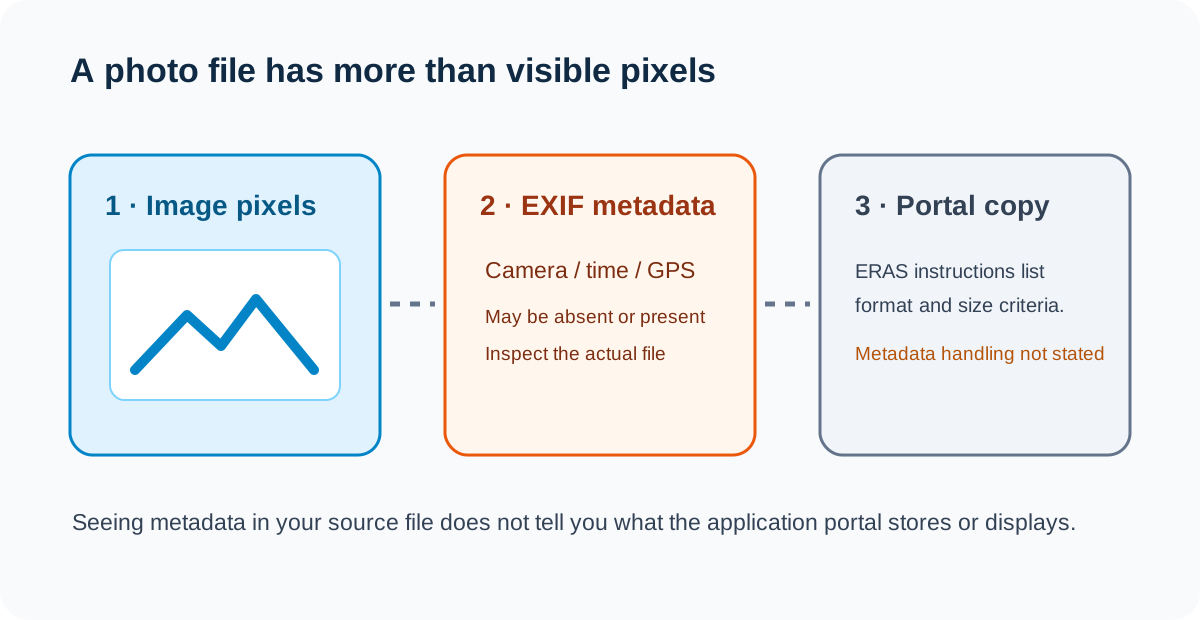
What location data can be inside a photo?
EXIF is a metadata format used by image files. Depending on the camera or editing workflow, a JPEG may include fields for the capture time, camera make and model, orientation, or GPS coordinates. A location field is optional: an image can have no GPS information, and a file’s name or visible pixels do not tell you whether the EXIF GPS directory is present. The ExifTool documentation lists GPS as a supported metadata group and describes reading and removing metadata from JPEGs.
That is a property of a file format and a particular file, not evidence about an application portal. The public AAMC direct-MyERAS photo checklist describes supported image formats, file size, centering, upload, and assignment. ECFMG’s IMG residency instructions describe a JPEG upload through MyIntealth, its technical limits, and later transmission to MyERAS. Neither public photo section reviewed here explains whether EXIF GPS, camera, or time tags are stripped, stored, or visible after upload. We did not log into an applicant account or submit any file.
Keep three questions distinct: what is embedded in your local source, what information an export contains, and what a service does with the upload. You can answer the first two by inspecting your own files. The third requires a statement from the service or a controlled test in an authorized account; a local image experiment cannot answer it.
A synthetic JPEG metadata test
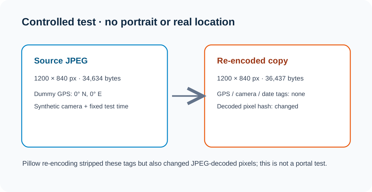
To make the difference concrete, we generated a geometric JPEG test card rather than using a person’s photograph. The first file was 1,200 × 840 pixels and 34,634 bytes. We wrote a dummy EXIF GPS location of 0° north, 0° east, along with synthetic camera labels and a fixed test timestamp. Those coordinates are deliberately fictional test data and are not a real photo location.
We reopened the JPEG, read its EXIF and GPS directories with Pillow, decoded the pixels, and re-encoded a separate copy at the same JPEG quality without passing the EXIF block. The new copy remained 1,200 × 840 pixels and measured 36,437 bytes. Its GPS, camera, and timestamp fields were absent when read back. Its decoded RGB pixel hash changed, as expected for a lossy JPEG re-encode; the operation was not a byte-preserving metadata-only edit.
| Local synthetic file | Bytes | Dimensions | GPS / camera / date tags | Decoded pixel hash |
|---|---|---|---|---|
| Source JPEG | 34,634 | 1200 × 840 | GPS dummy 0,0; synthetic camera and timestamp present | 4247892d…8e2eb54 |
| Re-encoded copy | 36,437 | 1200 × 840 | Not present after re-open | a29b9b65…1ba70fde |
The observation is narrow: in this generated pair, metadata was present in one file and absent in the re-encoded copy while dimensions stayed constant. The export grew by 1,803 bytes, so removing metadata did not make this particular file smaller. The changed decoded-pixel hash also means “metadata removed” and “identical image data” are not interchangeable claims. None of these numbers predicts what a real phone photo contains or what an ERAS service does to a submitted file.
Download the synthetic source JPEG and re-encoded no-EXIF copy. Exact file hashes, tags, pixel hashes, and the reproducible Pillow script are in the measurements record and test script.
A local check that keeps the portal question separate
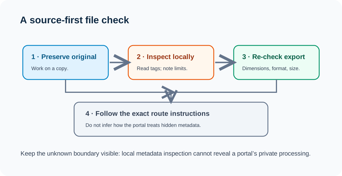
- Keep the original unchanged. Make a working copy before editing. Record which file you are inspecting so a cleaned export does not replace your source by accident.
- Inspect locally. Use an offline image-metadata viewer to list EXIF and GPS fields. Look for a GPS directory and camera/time tags. A blank GPS section means that this inspected copy did not report GPS tags; it says nothing about another copy or the service upload.
- If you export a clean copy, inspect it again. Some workflows strip metadata while re-encoding, but may also change image bytes, dimensions, or file size. Compare the exact export, not the original. Keep a backup and record the tool and settings.
- Re-check the route’s actual photo requirements. Metadata inspection does not replace format, file-size, dimension, framing, or assignment checks. The AAMC and ECFMG instructions describe different upload paths; use the official section that matches your application.
- Do not infer server behavior from the local result. The sources reviewed here do not state whether MyERAS or MyIntealth strips or preserves every metadata field. For an account-specific question, consult the route’s official support information rather than treating the synthetic test as a portal result.
This workflow deliberately ends at the boundary of what a local copy can establish. It neither says a portal exposes location data nor promises that it removes it.
Common questions
Does an ERAS headshot always have GPS coordinates?
No. GPS fields are optional metadata. Inspection of the exact image file can show whether that copy contains GPS tags.
Will MyERAS or MyIntealth remove the location data?
The public photo instructions reviewed here do not state how either system processes EXIF GPS or other metadata. The local test above does not determine that.
Does deleting EXIF metadata change the visible photo?
It depends on the method. In this test, the re-encoded image kept its pixel dimensions but its decoded RGB hash changed because it was saved again as JPEG. The test is not a comparison of every editing tool or setting.
Is a clean metadata copy automatically an acceptable ERAS photo?
No. Metadata checks are separate from the official route’s file type, size, image dimensions, and other published requirements. Verify the current checklist for the account and upload path you use.
Video explainer
This English explainer uses a synthetic JPEG pair to show what local EXIF inspection can and cannot establish. English narration includes burned-in English captions; narration is AI-generated.
Sources and scope
- AAMC, Photo — direct MyERAS upload, listed formats/file-size criteria, and photo assignment; the indexed official page text was reviewed, but its live page returned a JavaScript challenge during this check.
- ECFMG, ERAS: Supporting Documents — Photograph — current IMG-route JPEG, size/dimension, MyIntealth upload, and transmission instructions.
- ExifTool FAQ — metadata and GPS tag inspection/removal documentation; used for file-format context, not ERAS portal behavior.
- r/privacy, “Can someone on reddit find out my exact location from metadata in a picture I uploaded onto the site?” — a public question about photo metadata privacy, used only as a human question signal.
Official wording and question source checked October 29, 2026. The experiment uses a generated graphic and dummy coordinates; no real person, location, camera, MyERAS account, or MyIntealth account was involved. The public AAMC page presented a JavaScript challenge to the text reader. Search Console was not read today because this is not the cycle-report date; no Google query or search-volume claim is made. Residency Headshot is independent and is not affiliated with AAMC, ECFMG, Intealth, or ERAS Support Services.